Mam Tor Walking Routes
The views from the top of Mam Tor and The Great Ridge just keep me coming back for more!
The Mam Tor Ridge Walk is definitely one of my favourite hikes in the Peak District. Taking just 3-4 hours and showing some of the best views in the area, the walking route is a must for anyone visiting Castleton or Hope Valley.
Keep reading to discover my favourite Mam Tor walking route and everything you need to know about this scenic summit…
P.S This post may contain affiliate links. If you click and purchase, I'll earn some cuppa money, which I promise to drink while continuing to create content for you. I only ever recommend products and places that I personally love and use myself.
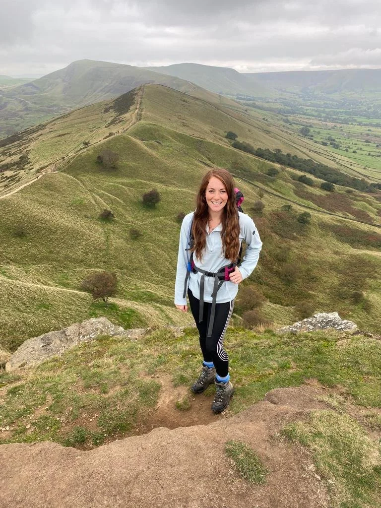
Mam Tor, Peak District
Mam Tor is a picturesque peak in the heart of the Derbyshire Peak District. It’s one of the most popular walks in the Peaks and it’s not hard to see why - with panoramic views of some of the most breathtaking parts of the Peak District.
Where is Mam Tor?
Mam Tor is located just outside the charming village of Castleton in the Peak District. This popular peak dominates the area around Castleton, with many different routes to its summit.
The mountain can be found near one of the most photographed parts of the Peak District; the iconic Winnats Pass. (Check out this video of Winnat’s Pass to see its beauty for yourself!)
Looking for the right OS Map? You’ll find Mam Tor on the Map of the Peak District - Dark Peak Area map.
How High is Mam Tor?
Mam Tor is 517m high. Despite its height and dramatic silhouette, Mam Tor is relatively easy to climb and deserves a place on any adventure bucket list.
How long does it take to walk up Mam Tor?
Depending on which route you take, the ascent and descent of Mam Tor can be completed in just 1-2 hours. However, my favourite route - The Mam Tor Ridge Walk, can take up to 4 hours to complete.
Top Tip - try to avoid school holidays and weekends as Mam Tor can get quite busy!
Where does the Mam Tor walk start? | Mam Tor Parking
The Mam Tor Ridge Walk starts from the main car park in Castleton.
If you’re wanting to complete the shorter Mam Tor Circular Walk, then the start is from the National Trust Mam Nick Car Park (Pay and Display).
Both routes are described below.
Mam Tor Walking Routes
Mam Tor Short Circular Walk
5km | 2 hours | Starting Point: Mam Nick Car Park
Climb the steps at the top of the car park. Follow the path along the road to a small gate and National Trust sign.
Go through the gate and bear left.
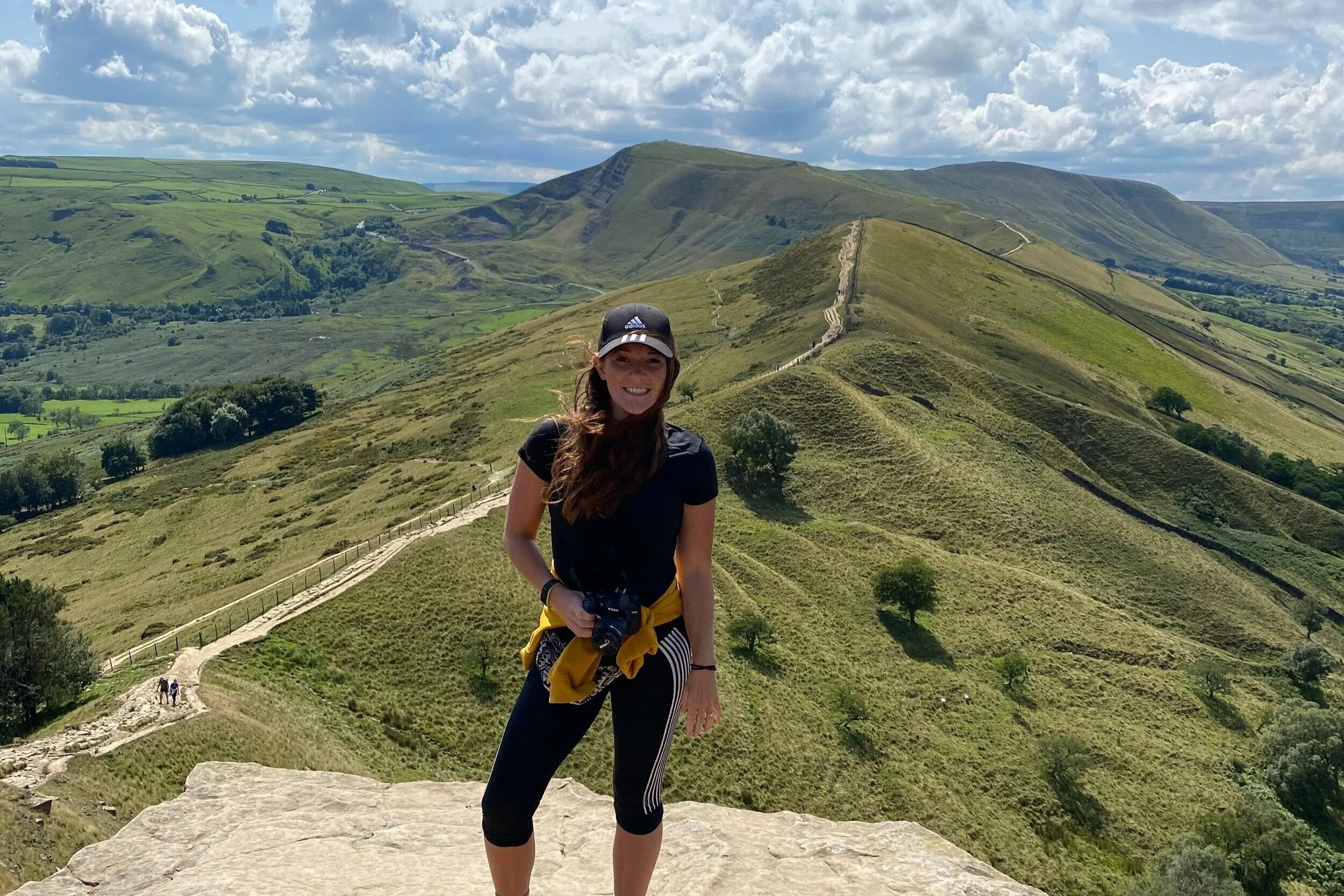
Climb the stone step towards the summit of Mam Tor (stop and admire the dramatic views of the Peak District).
Continue along the stone path to the summit.
After admiring the views (and enjoying a well-earned breather), continue north along the flagstone path.
The path will become noticeably steeper. Continue until you come across a small monument in a dip in the ridge.
Turn right downhill, back towards Mam Tor.
Just before reaching the trees, take the right fork around the woodland.
Continue on the path to the road.
Walk up the road and through a gate. Continue walking along a broken road.
Pass through a gate and parking area. Turn left down the track to Blue John Cavern.
Continue past a building at the mine's entrance and go through a small gate.
After passing through the gate, continue up a grassy path.
Bear right at the top of the hill and continue through a gate.
Cross the field and road and take the left fork, uphill.
Here you’ll see an entrance of another cave; Windy Knoll.
From here, cross the field and go through a small gate and cross the road.
Continue along the grass verge, back to the car park.
Route map for Mam Tor Short Circular by Katy Barley on plotaroute.com
Mam Tor Ridge Walk (Castleton - Mam Tor - Back Tor - Lose Hill)
13km | 3-4 hours | Starting Point: Castleton Visitor Centre
From the visitor centre, take a left at the roundabout along Cross Street.
Opposite the Bull’s Head, turn right up Caste Street towards Peveril Castle.
Turn left at the top of the road, passing the triangular war memorial on your left.
Bear right, leading to Pindale Road.
Take the track between Cavedale Cottage and Dale Cottage on your right.
Continue along the Limestone Way as it opens into an impressive limestone valley (Cave Dale).
Pass Peveril Castle on your right and continue along the valley until you reach a drystone wall.
Pass through the wall and continue for 1km with the wall on your right.
Upon reaching another gate, continue on until you reach an intersection of paths and gates.
Turn right and cross over a stile onto a walled track.
Follow the bridleway and turn right where it forks.
Walk past Rowter Farm and continue along the long track until you reach a road, with Mam Tor in the background.
Continue along the path until you reach a second road.
Cross the road and pass through a small gate on the other side.
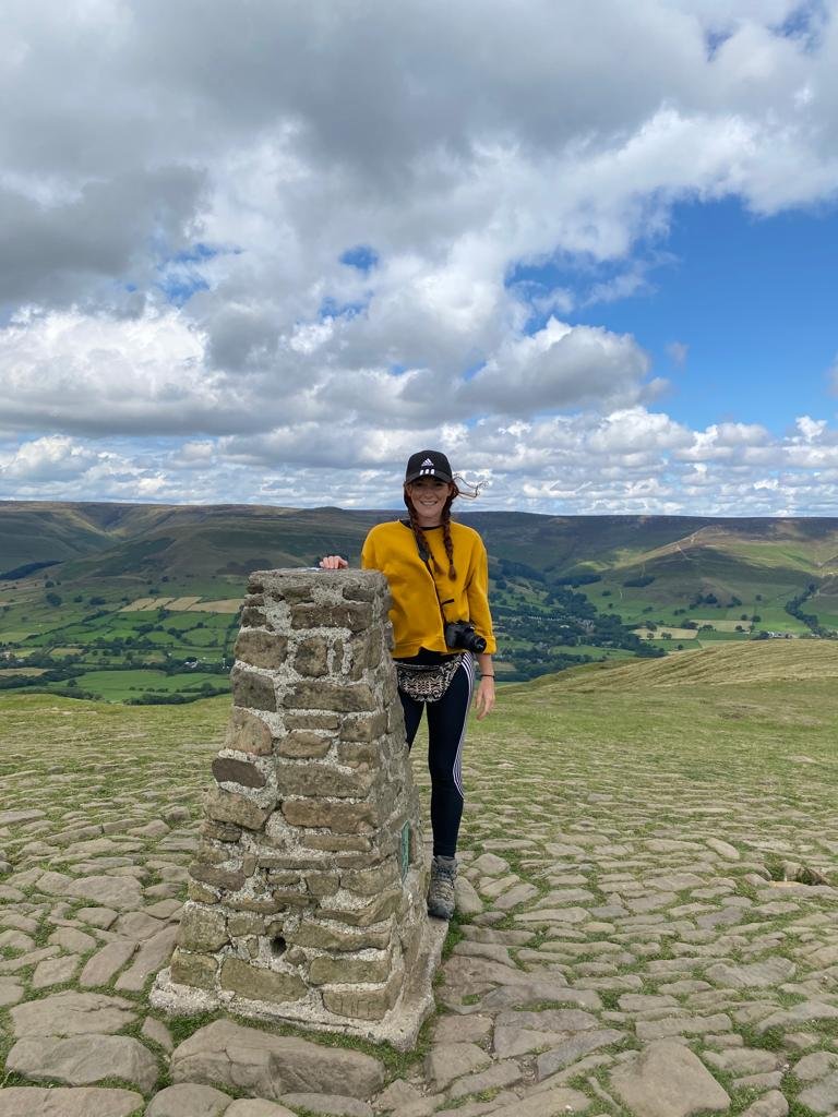
Follow the well-pathed route between Mam Tor and Rushup Edge. Continue up the steps towards the summit of Mam Tor.
Yay - you did it! Enjoy a breather and take some pics!
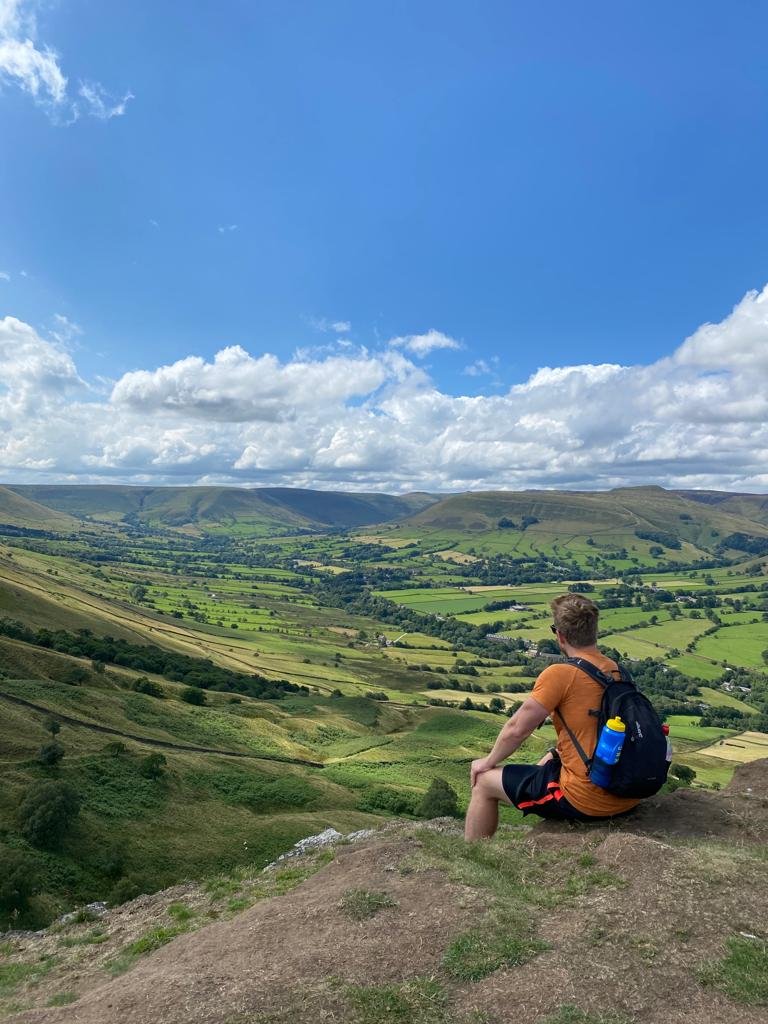
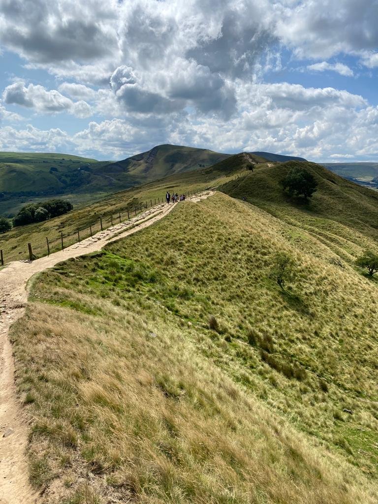
From the summit, bear slightly left, along the well-marked out path. Continue along the Great Ridge.
Continue along the Great Ridge, taking in the views, until you reach Hollins Cross.
Ignore the paths deviating away from Hollins Cross and continue along The Great Ridge, with a view of Back Tor ahead.
Continue to the summit of Back Tor - a short, steep climb (but well worth it!).
Upon reaching its peak, take a moment to look back at the breathtaking views of Mam Tor.
Continue along the Great Ridge, between the wall and fence.
Make your final ascent up Lose Hill.
A path leaves Lose Hill in a south-easterly direction (a slight right) until it reaches a gate.
Pass through the gate and bear right until you reach a fence. Bear left, heading downhill with the wall on your left.
Follow this path to Losehill Farm.
Before reaching the farm, turn right across the field, to a small gate leading to a track.
Follow the track to Spring House Farm, then follow the track leading off to the right, crossing a small stream and heading west to Losehill Hall.
Turn left at Losehill Hall and follow the track to the A6187.
Here, turn right, cross Sital Bridge and make your way back to Castleton.
Route map for Castleton - Mam Tor - Lose Hill by Katy Barley on plotaroute.com
Mam Tor is definitely one of my favourite hikes in the Peak District! What’s yours? I’d love to know in the comments below - or drop me a message on Instagram!
Other posts that might interest you;